You guys following this thread?
http://www.virtualjeepclub.com/showthread.php?65266-Wallow-fire.
Serious fire eatin' up land in the White Mountains...
http://inciweb.org/incident/2262/
FORUM ARCHIVE — READ ONLY
Read-Only Archive — 68,067 posts · 4,889 threads · 2,978 members · preserved from 2006–2015
Wallow fire
Jun 05, 2011 12:36 AM #1
Jun 05, 2011 12:40 AM #2
yeah we used to go camping all the time around big lake, hopefully it goes east of it
Jun 05, 2011 03:55 PM #3
I don't have permission to view that therad :O
Jun 05, 2011 07:37 PM #4
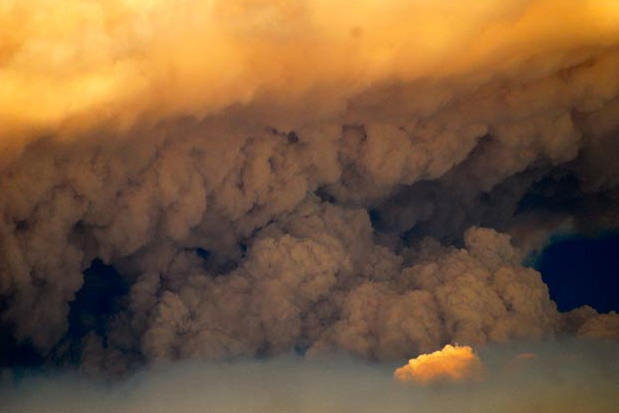
Reminds me of the Chediski and all of us being ready for evacuation orders its truly sad once again to see this and already its out of control there is no man power big enough to fight this kind of fires.I was on the Draw this past weekend and there was a big vjc run out there and saw people pitching lit ciggarett buts all over the place makes me sick to see that not many care or love for the land anymore,once it burns its closed forever in our lifetime
Jun 06, 2011 05:53 AM #5
Reminds me of the Chediski and all of us being ready for evacuation orders its truly sad once again to see this and already its out of control there is no man power big enough to fight this kind of fires.I was on the Draw this past weekend and there was a big vjc run out there and saw people pitching lit ciggarett buts all over the place makes me sick to see that not many care or love for the land anymore,once it burns its closed forever in our lifetime
You got that right TC, and I'm a smoker. However I will put it on my mother that we are going to get FR42 open in the next year max. Hoping by end of this year.
You got that right TC, and I'm a smoker. However I will put it on my mother that we are going to get FR42 open in the next year max. Hoping by end of this year.
Jun 06, 2011 04:23 PM #6
I guess that fire got worse over the weekend
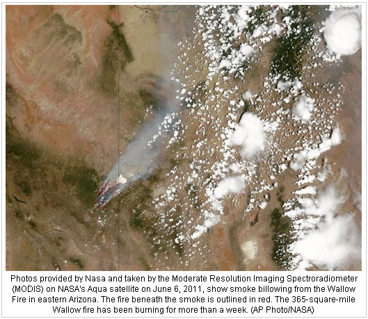
301 square miles burned and 0 percent contained
headed towards Greer
301 square miles burned and 0 percent contained
headed towards Greer
Jun 06, 2011 04:54 PM #7
Another scary growth map
http://hikearizona.com/map.php?QX=769
3:30am this morning
http://hikearizona.com/dex2/download/file.php?id=2198&mode=view
http://hikearizona.com/map.php?QX=769
3:30am this morning
http://hikearizona.com/dex2/download/file.php?id=2198&mode=view
Jun 06, 2011 05:03 PM #8
This one's good too. You can change the baselayer for streets/topo on the left side too.
http://www.geomac.gov/viewer/viewer.shtml
So much lost
http://www.geomac.gov/viewer/viewer.shtml
So much lost
Jun 06, 2011 05:07 PM #9
I hope Big lake makes it. I spent most my summer vacations there as a kid learning to fish. I love that area.
Jun 06, 2011 05:13 PM #10
fatbob309 wrote:I hope Big lake makes it. I spent most my summer vacations there as a kid learning to fish. I love that area.
It was all but surrounded this morning. That Black River hike I didn't end up doing last year is gone
Jun 06, 2011 06:12 PM #11
Skatchkins wrote:This one's good too. You can change the baselayer for streets/topo on the left side too.
http://www.geomac.gov/viewer/viewer.shtml
So much lost
This was a very helpful map. Thanks Mike.
Jun 07, 2011 04:25 AM #12
So sad. Was told the forest around big lake is gone. Feel like I lost a part of me.
Jun 07, 2011 04:34 AM #13
Govt posted evac checklist: http://www.eagaraz.gov/misc_pdf/SKMBT_C55211060216520.pdf
Jun 07, 2011 02:57 PM #14
My cousin Matt just got called up with 20 other Phx Fire to go help in Springerville/Eager. They think the fire might make its way to the city and they are there to protect the buildings
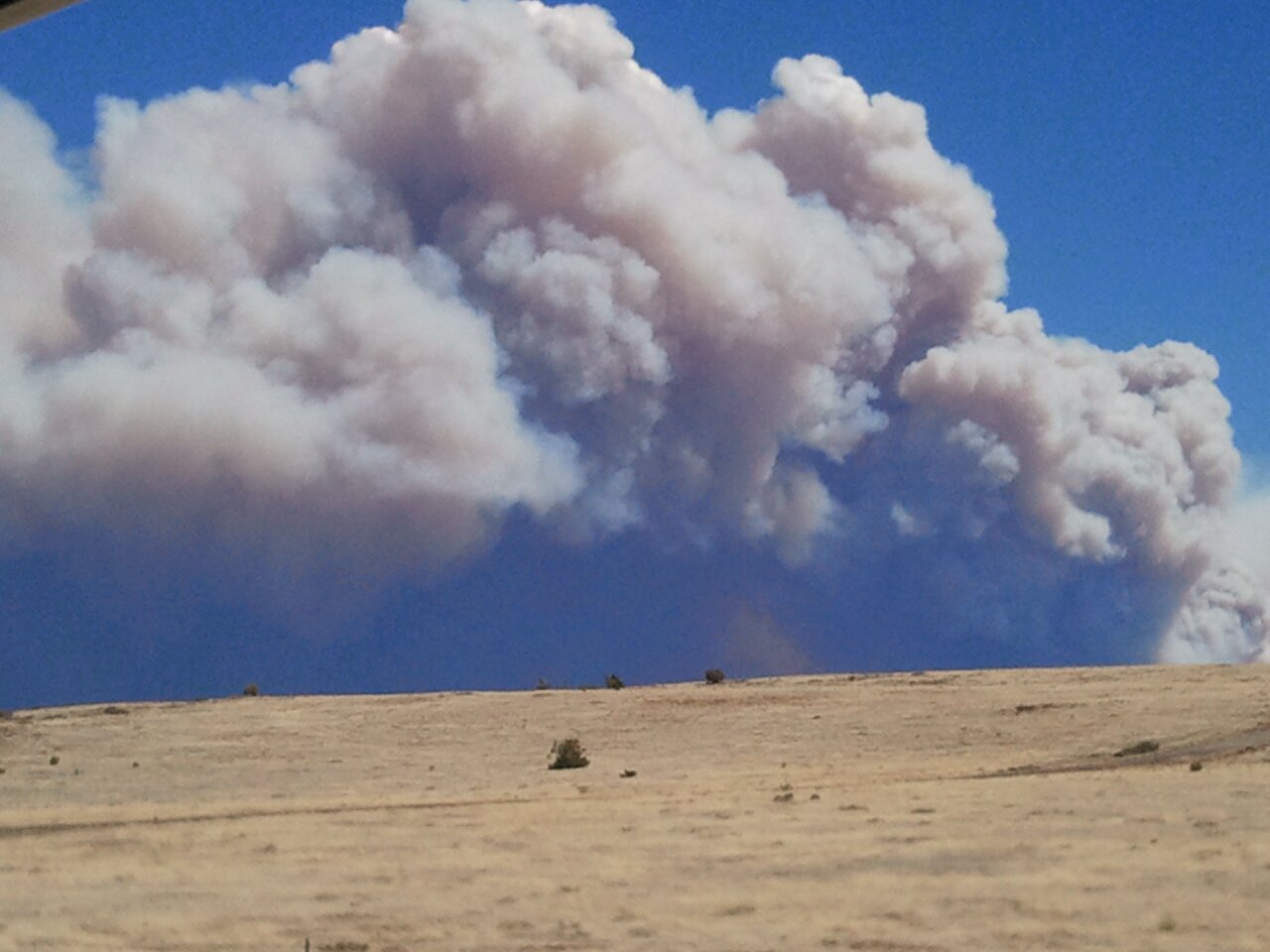
Jun 07, 2011 10:12 PM #15
he sent me this pic just outside alpine
Jun 08, 2011 12:22 AM #16
Just heard on the news that fire has grown to big to stop, they are going to try and save as many structures as possible and let it burn...
Jun 08, 2011 04:08 AM #17


Jun 08, 2011 04:14 AM #18
Crazy that it was two different careless fires
Jun 08, 2011 03:30 PM #19
Progression map
http://www.azcentral.com/news/wildfires/wallow/wallow-fire-timeline.php
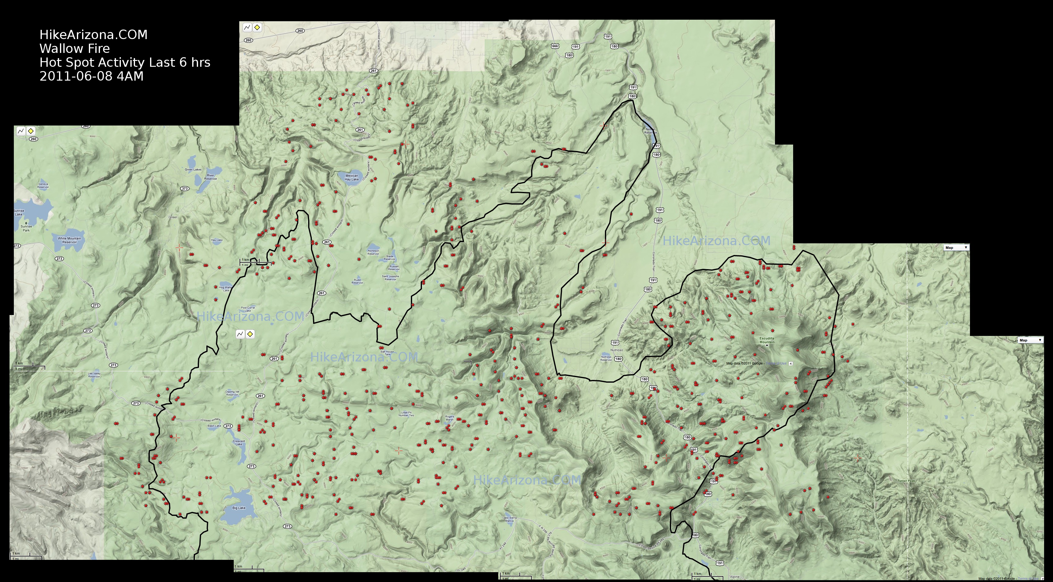
Hot spot map 6-8-11 4am
http://hikearizona.com/t2011/06/08/O_23-15637_1307419427-16.jpg
http://www.azcentral.com/news/wildfires/wallow/wallow-fire-timeline.php
Hot spot map 6-8-11 4am
http://hikearizona.com/t2011/06/08/O_23-15637_1307419427-16.jpg
Jun 08, 2011 03:33 PM #20
talked to my cousin this morning, he spent the night on watch duty putting out any spot fires from hot ash in springerville, said it was a quiet night
he was told that they expect the fire to hit the edge of town sometime this evening
he was told that they expect the fire to hit the edge of town sometime this evening