|
 |
 |
|
So anyway, while I was actually impressed that the little lady
in my GPS told me how to get down off of Four Peaks and had
even some of the ruttiest roads marked, that's really not what
I got it for. Like I said before, with a map, even
though you know where you want to be, it's hard to actually
get there. It's also almost impossible to take a map and
try to make it sync with a small dark screen coordinates only
GPS like Chris's old Etrex. You'll drive yourself crazy
trying to guess what canyon or contour of the topo you are in.
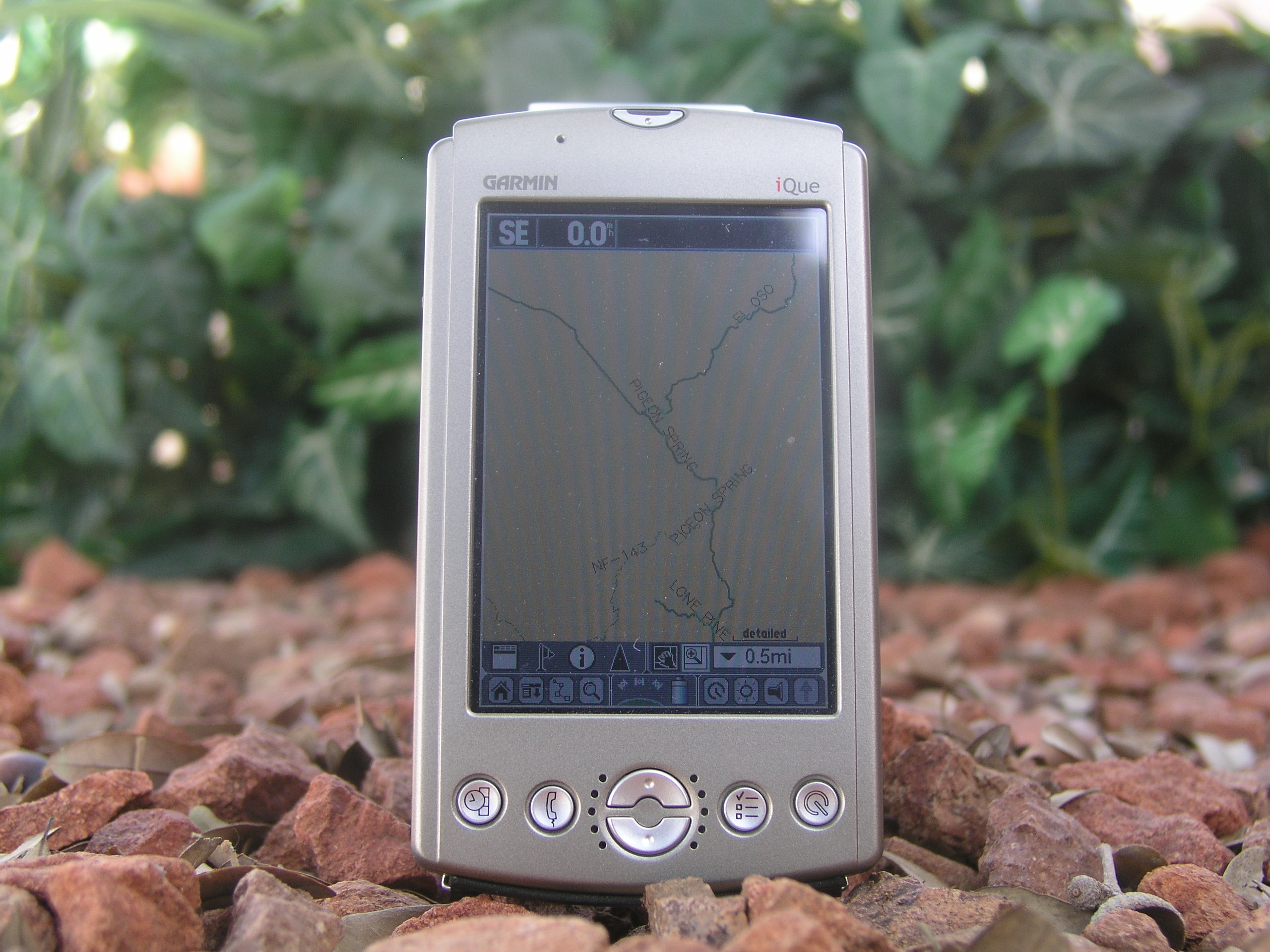
I really wanted a topo map that showed where I was and moved
when I moved. That's the main reason I got the Garmin.
Garmin does have some topographic map software but the Maptech
maps were better and I was used to them.. For only $20
you can download their software and use all the maps you want.
That also meant no more splicing small quads together.
By looking up the area you want on their map page, you could
just select that area and add it right to your GPS. It
was still pretty detailed when you looked it over and you
could add all the waypoints you wanted. And like I said,
most caves and mines are already listed. |
 |
|
 |
|
A really good example of this map
juggling took place on our misadventure recently down just
above the border in SE AZ on a caving trip. We really
weren't sure where we were going. Cave locations in AZ
are kept under extreme lock and key, and all we had was a
name. From that, using the net, we found a couple more
names, an obscure pic, and then finally a set of coordinates.
We took the other pics we were able to gather from various
sites of the entrances of caves, plugged them into Google
Earth satellite imaging, matched that up that to a topo map
and then brought the whole mess of paper work with us. I
manned the small Etrex, someone else the topo, and the another
person, the other the photo's we printed of the hidden cave
entrances. With all that, after trying the wrong canyon
the first time, we were actually able to find where we were
supposed to be and began caving. 25 people, 10 vehicles,
1 ton of equipment, an ambulance, and a helicopter later, we
were able to get
Steve out- but that's another story entirely. ...So
with the iQue, I could have had all of that information accessible
at the touch of a button, with real time topo coordinates.
Plus, it would have been easier to get all those rescue people
out there with the exact coordinates. |
Back to the write-up
|
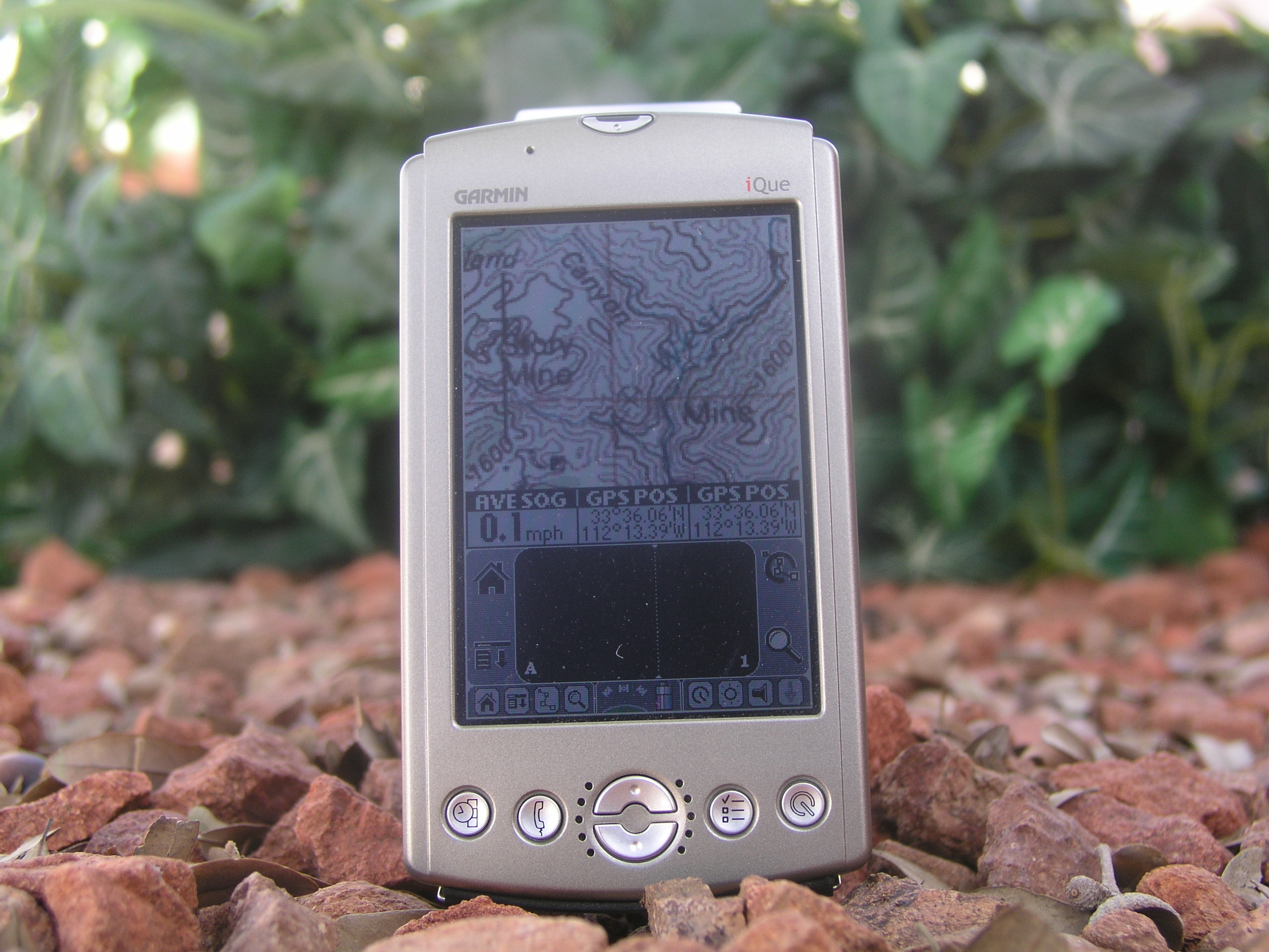
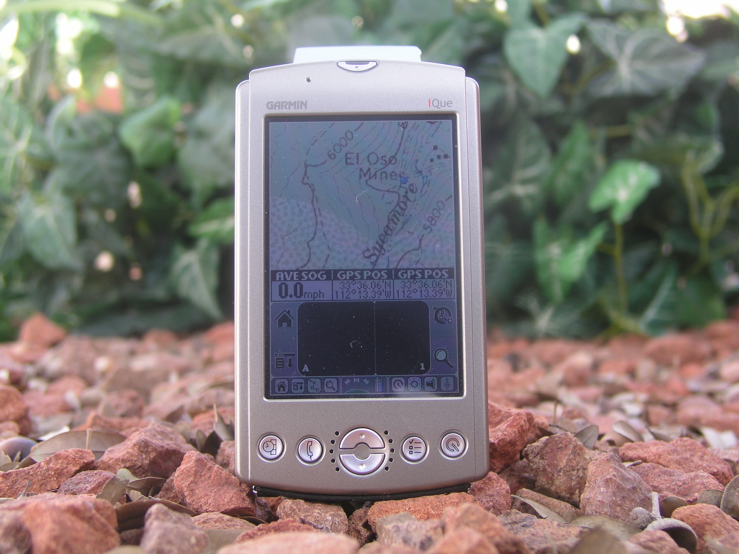
To really test my new GPS, I took it when we went camping in
the Four Peaks Wilderness areas. If you head to Four
Peaks and then as you get to it to the final trail turnoff,
blow past it a little ways, you can hook a left on FR422/El
Oso Rd and get to some pretty nice camping spots up on the
ridge. We were out there, and I wanted to check out El
Oso mine which the GPS topo said was close by. It
actually had an old mine road listed that I wasn't able to
find because it was so overgrown, so I headed out into nowhere
with only my GPS and a flashlight. I kept going towards
the waypoint I had marked over the "Y" mine marking on the
map, and finally as I reached the blue waypoint, the mine was
directly in front of me. My first attempt proved
successful! -and made me feel better about my pricey (for me)
investment.
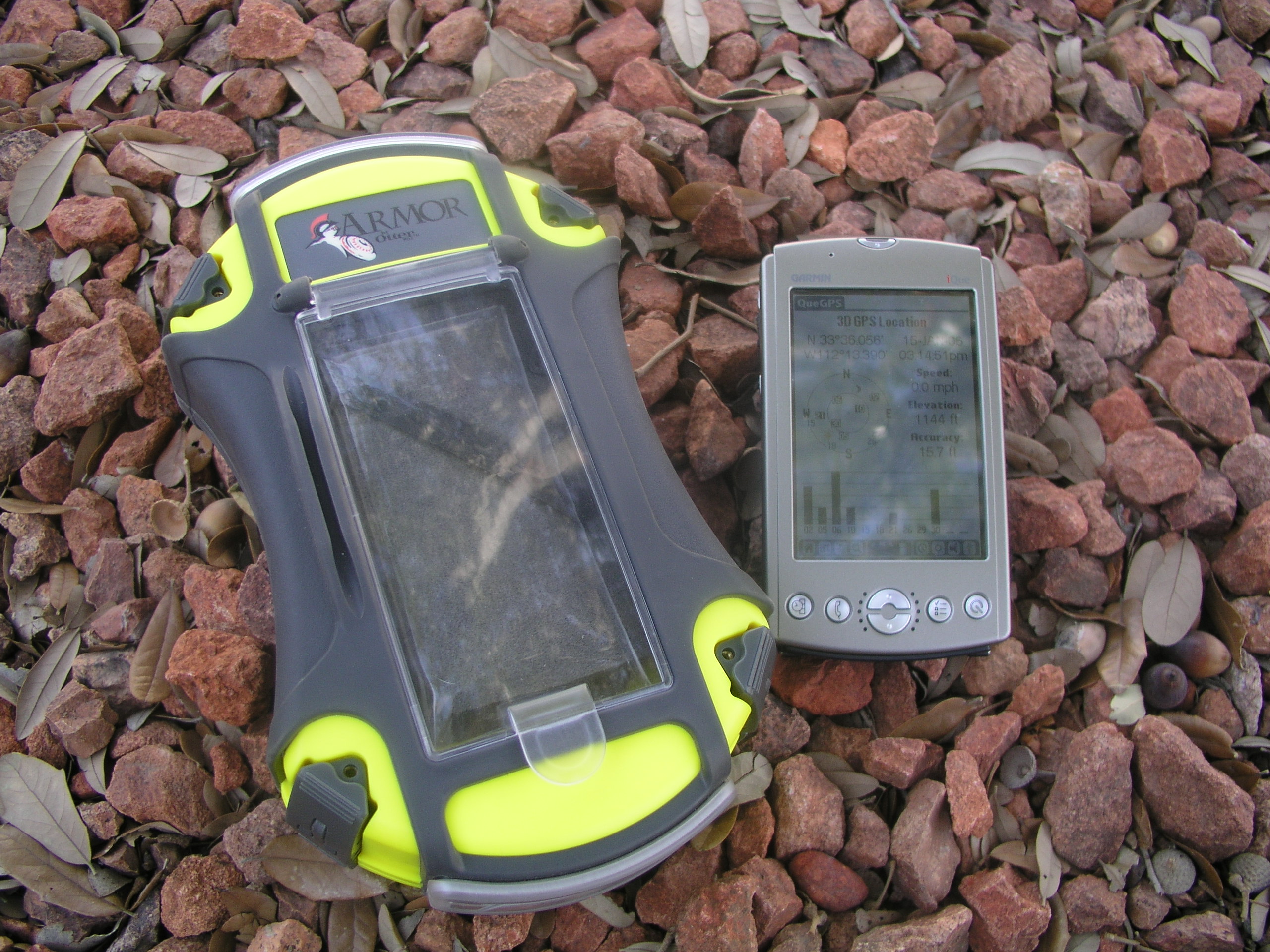
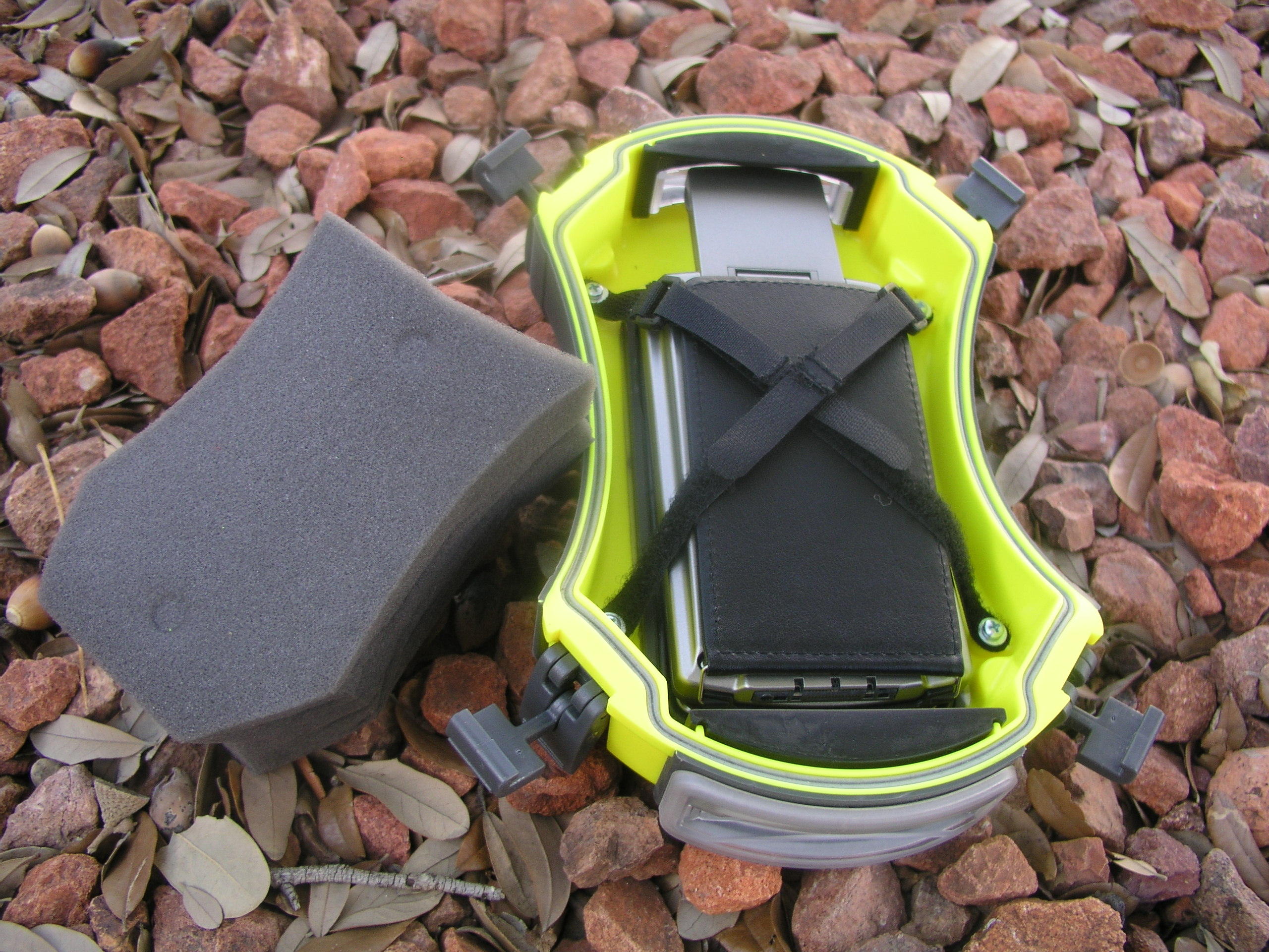
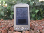
So when I got my GPS I knew I needed something to really
protect it when were out. I wanted it safe, but I didn't
want to have to baby it when running around with it, setting
it down, or even if it started raining. Chris pointed me
in the direction of Otter Box, a company like Pelican that
makes some really cool electronic protective cases. I
found that the 3600 was the size I needed, and also found that
it was waterproof, crush proof and virtually indestructible;
in fact they warranty the heck out of it too. All this
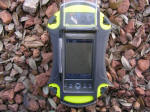
and the flip up GPS still had room.
They recommended a deep
case kit for it, but the iQue fits perfectly without it.
The Otter Box case is huge compared to the iQue, but it fits
it fine with the antenna flipped open. It has velcro
straps that secure it, plus a large piece of foam that keeps
it from moving at all. Once you strap it in and clip it
closed, your GPS isn't going anywhere.
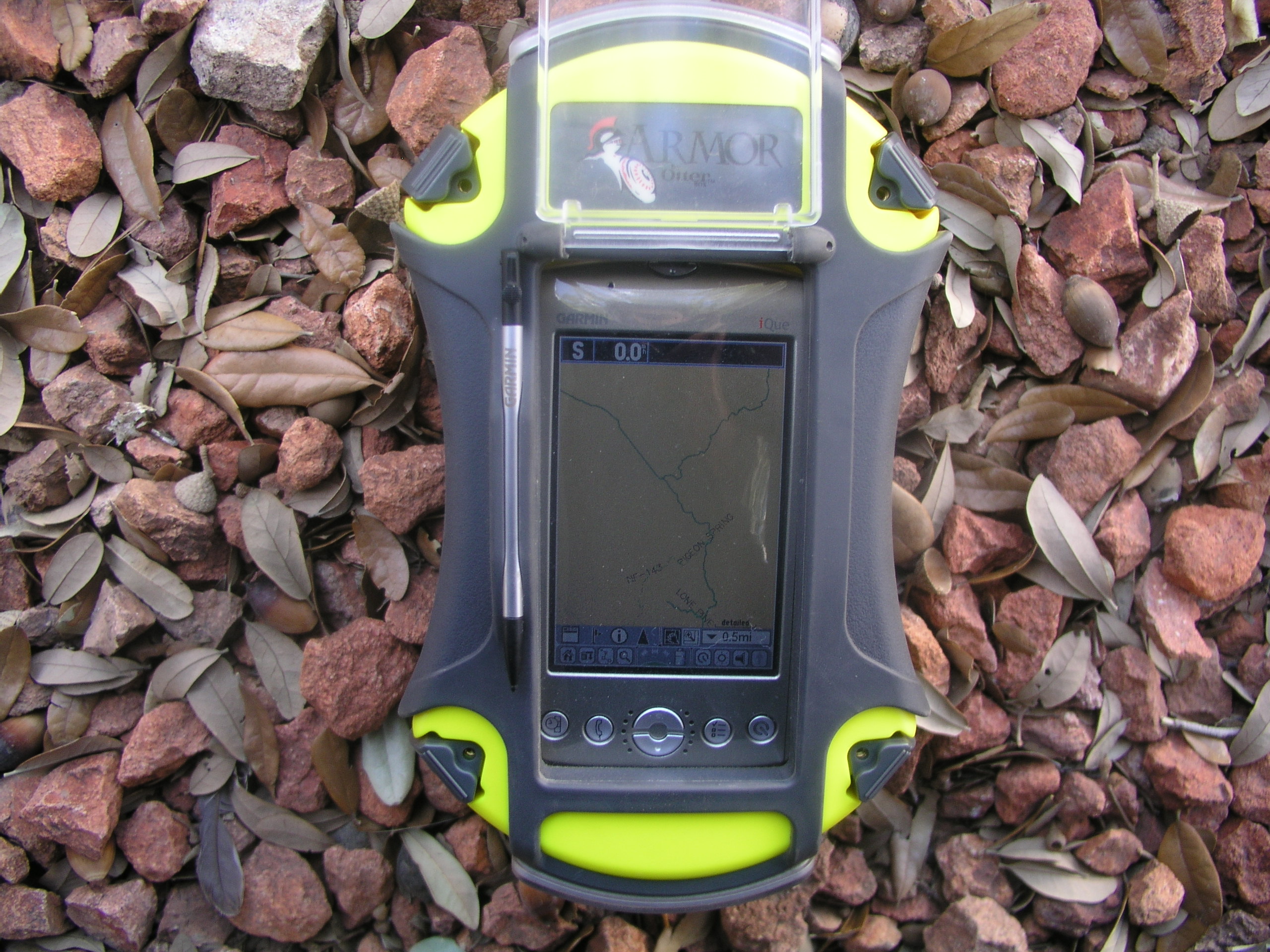
You can still use all of the screen functions and buttons
because underneath a flip up polycarbonate window is a thick
plastic seal that lays flat against the screen that the stylus
can write through. It also has a thick velcro strap for
latching onto and you can purchase a good bit of accessories
if need be, such as wire-through end pieces that still retain
the box's waterproof capabilitites.
I also chose the Garmin due to it's portability. You'll
be hard pressed to find a comparable GPS that isn't restricted
to your dash. A lot of this has to do with battery life.
While the iQue's battery will allow roaming use, it is a
little on the low side of impressiveness. The PDA
functions of it will keep the battery lasting for a while, but
flip up the antenna and you are limited to 2-3 hours of use.
That's not a problem for us, because we usually have it
plugged in to the vehicile until we get to an area we want to
check out, and then that leaves us plenty of batt for hiking
to our destination. If we were going on a long hiking
trip we could always switch out between the old Etrex when we
didn't need as much info. Oh, and I got the case, that
retails for $100, on Ebay too for $65.
So all in all, I believe I made a great decision, and with the
Otter case, my investment is very well protected. I'm a
super glad I went with a company like Garmin who's service
definitely does not end as soon as their product leaves their
doorstep. |
 |
 |
 |
 |
 |
|
|
Every once in a while, I'll actually use my GPS around town if I
don't know a destination's location but it is right at home and just
as impressive out on the trails where I use it the most (besides
that multitasking personal time we spoke of earlier). Just
being able to not shuffle my homemade maps around is another load
off.
I saved the spec page for last so you can see them all laid out
without all my added gibberish. Click the right headlight to
continue. Thanks again Garmin and OtterBox.
-Later
|
|