|
|
|||||||||||||
|
|
|||||||||||||
|
|
|
|
|
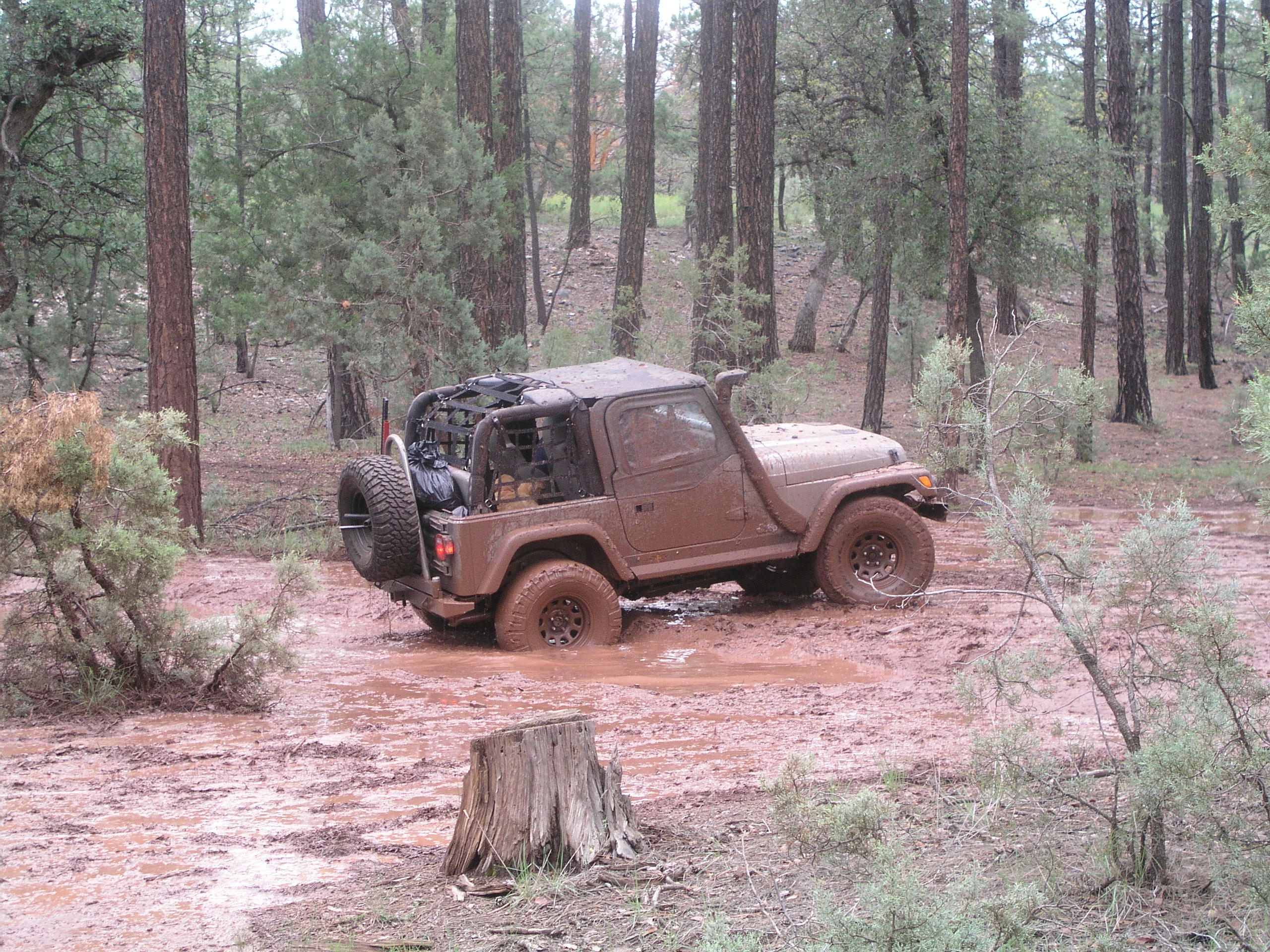
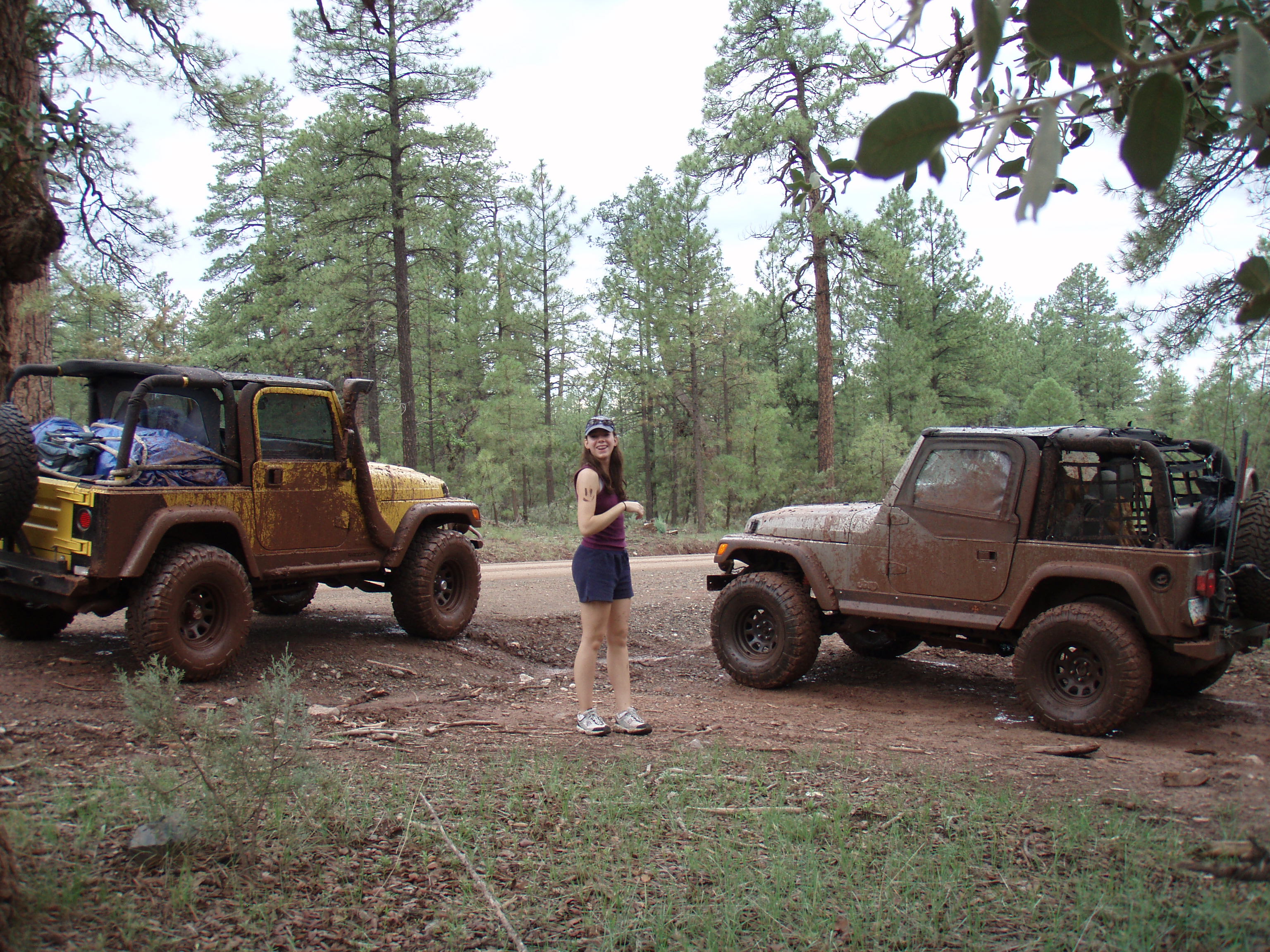
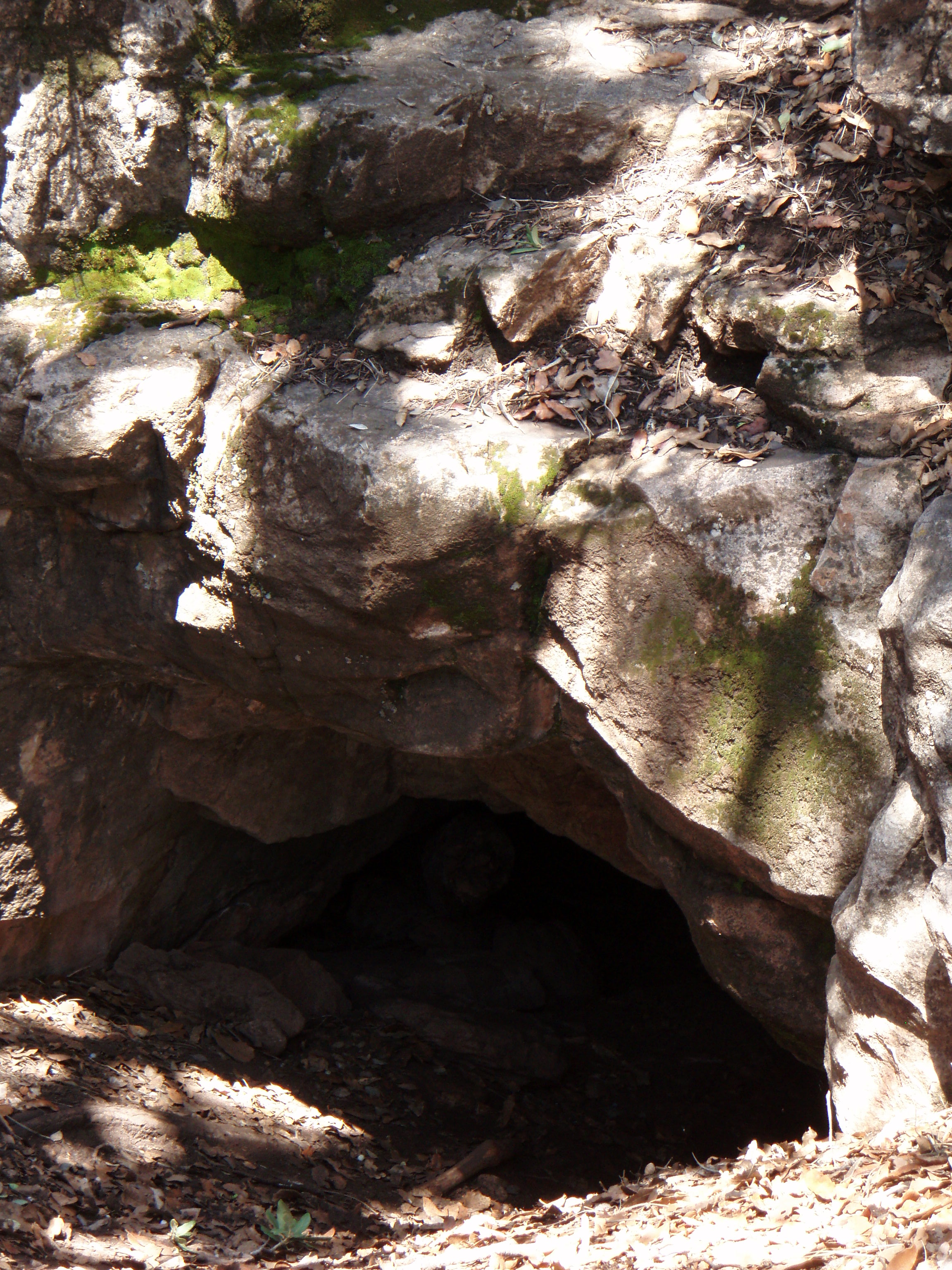
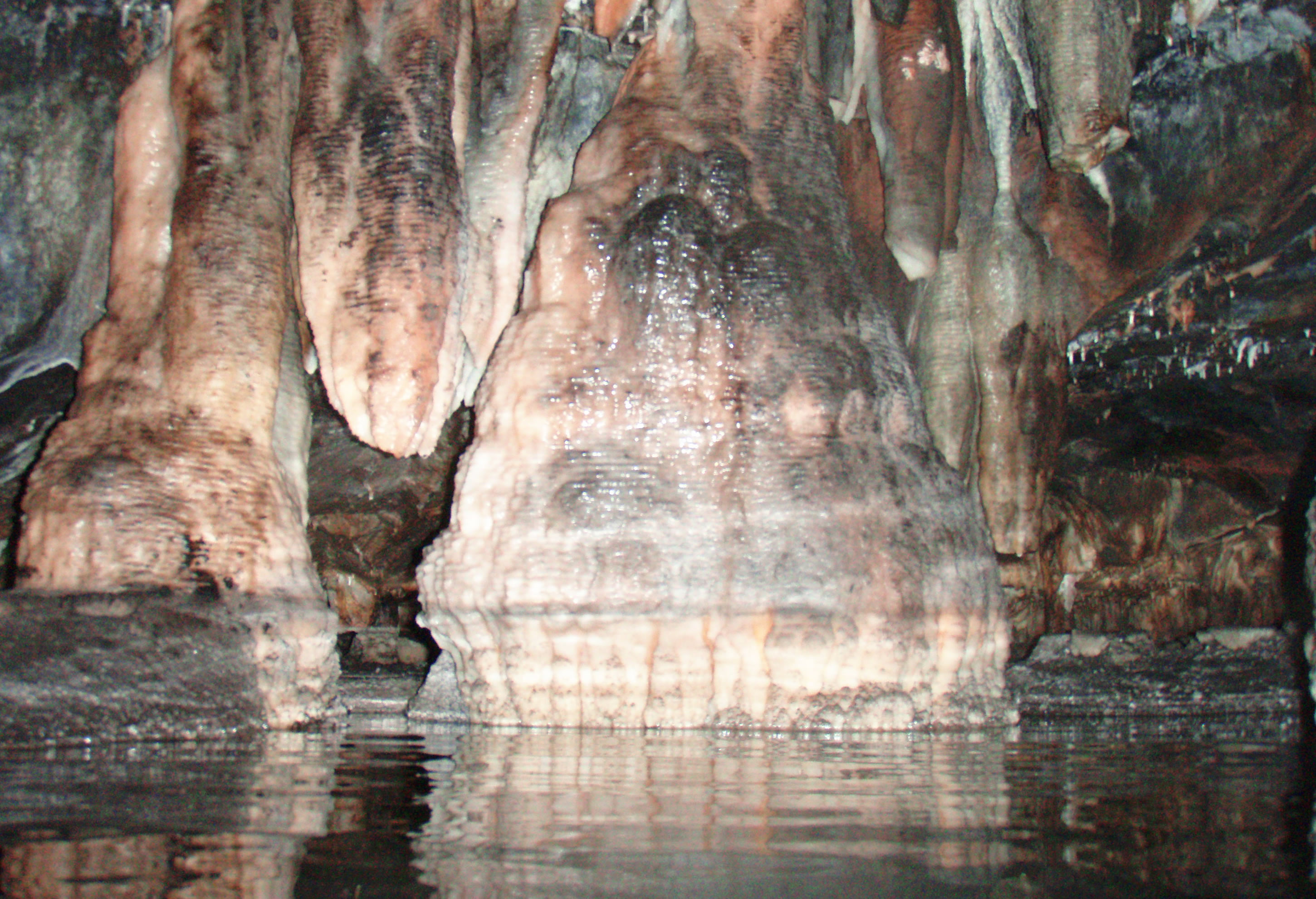
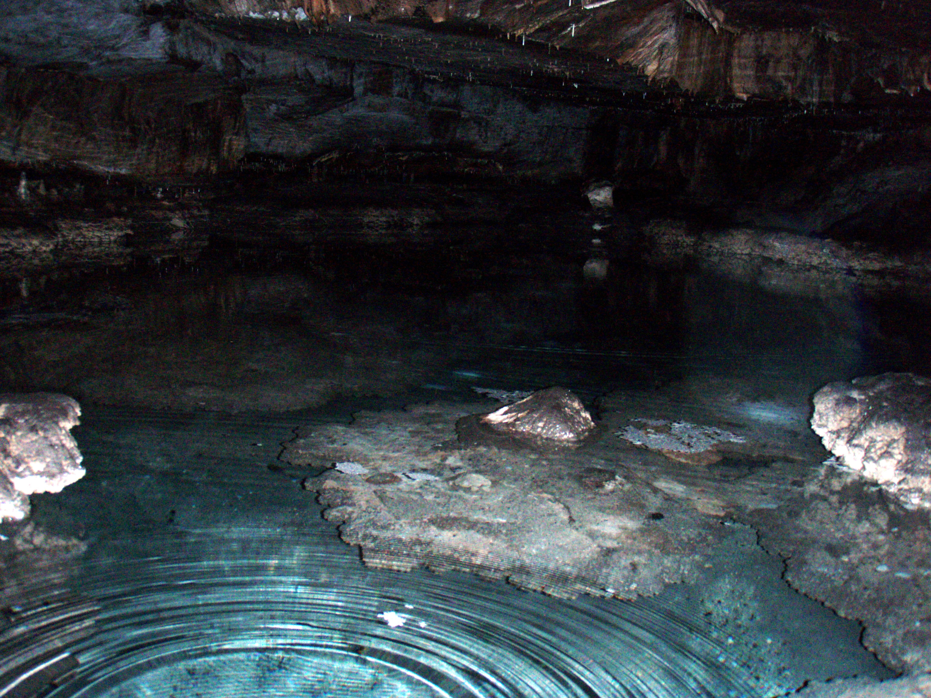
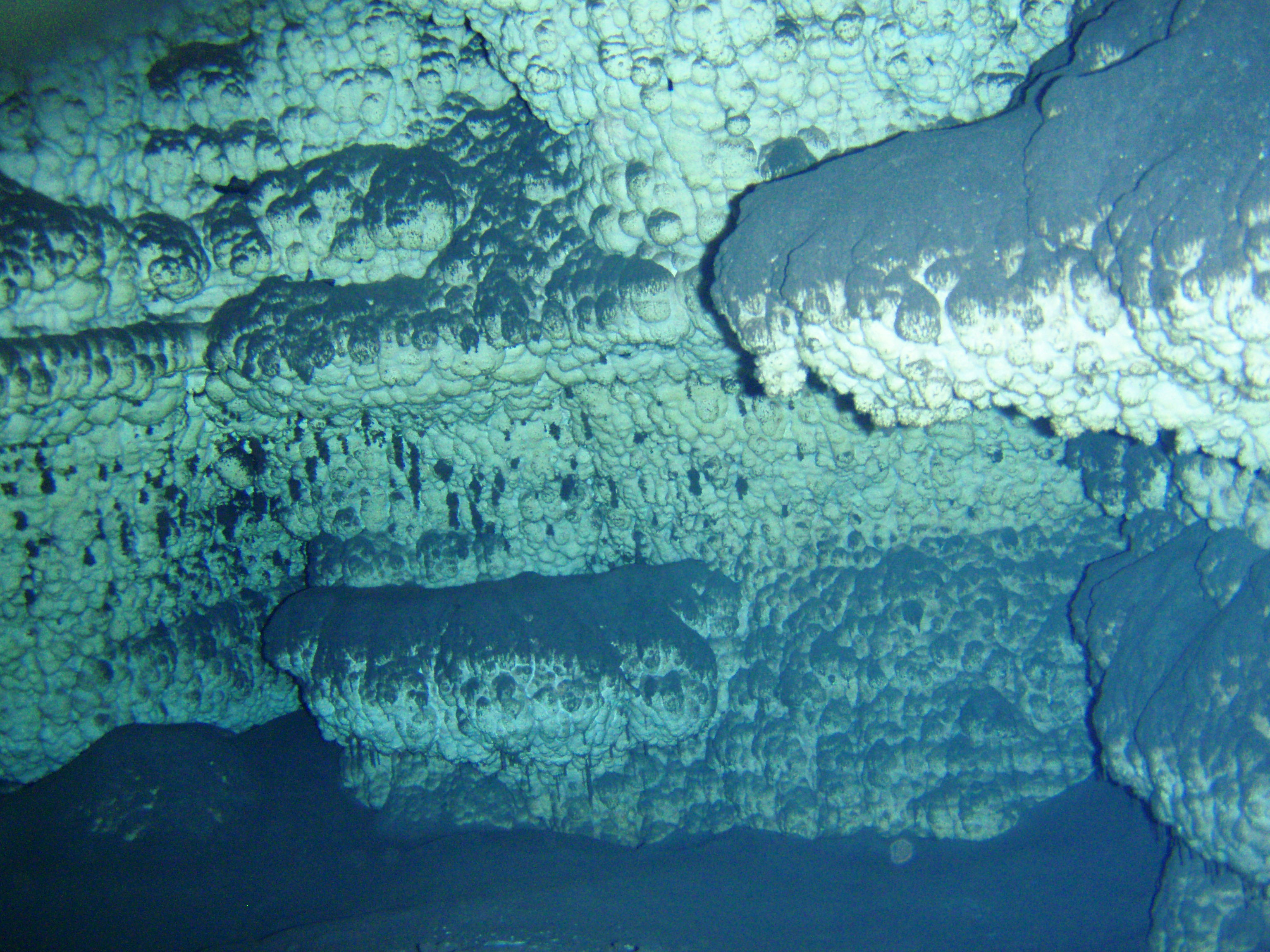
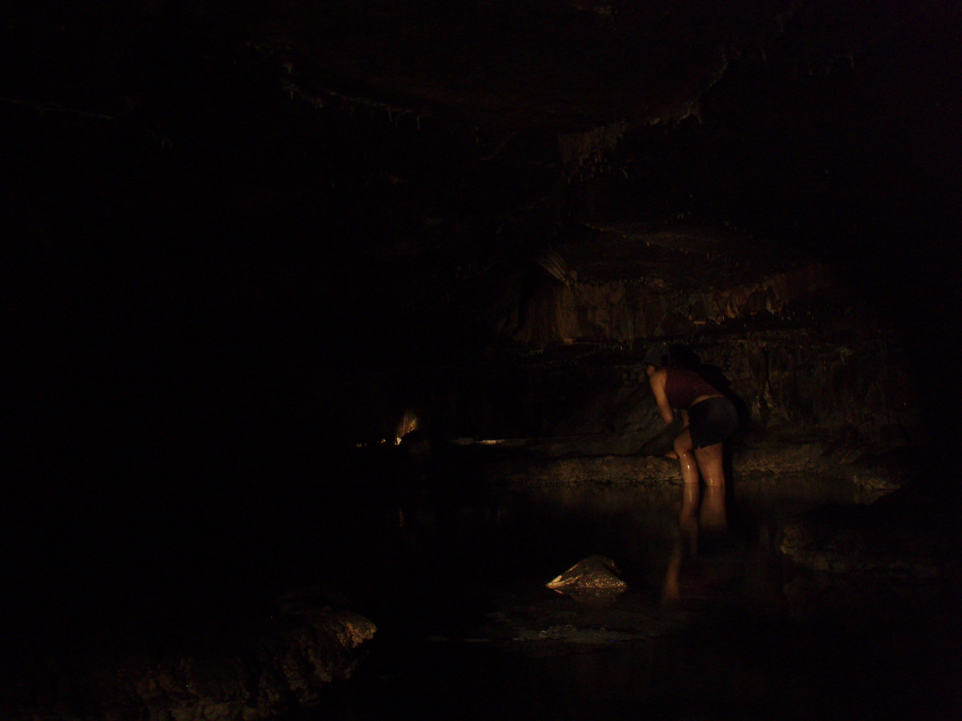
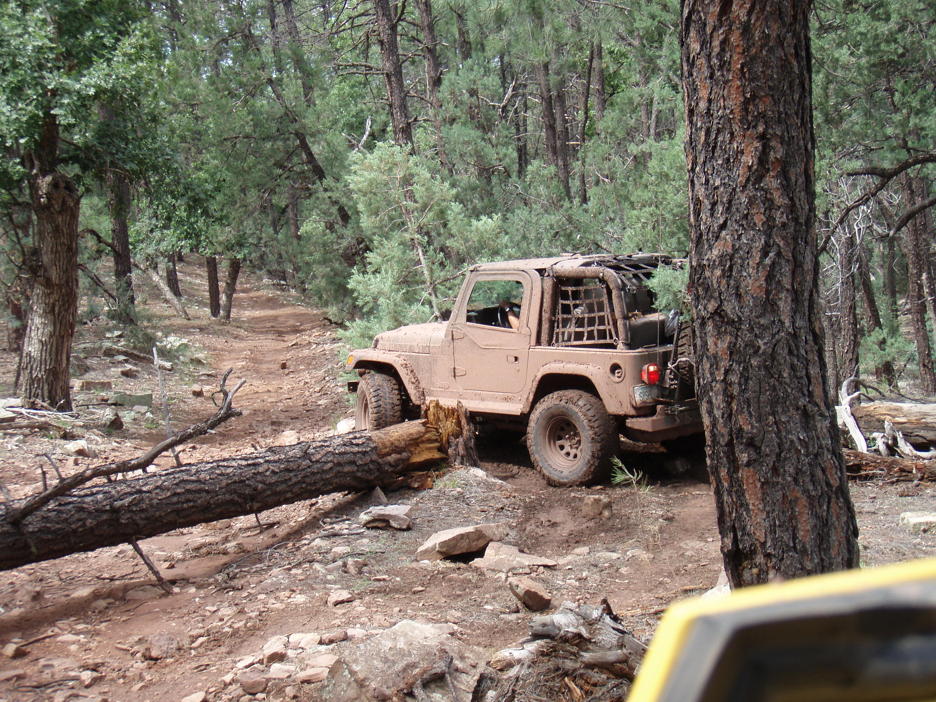
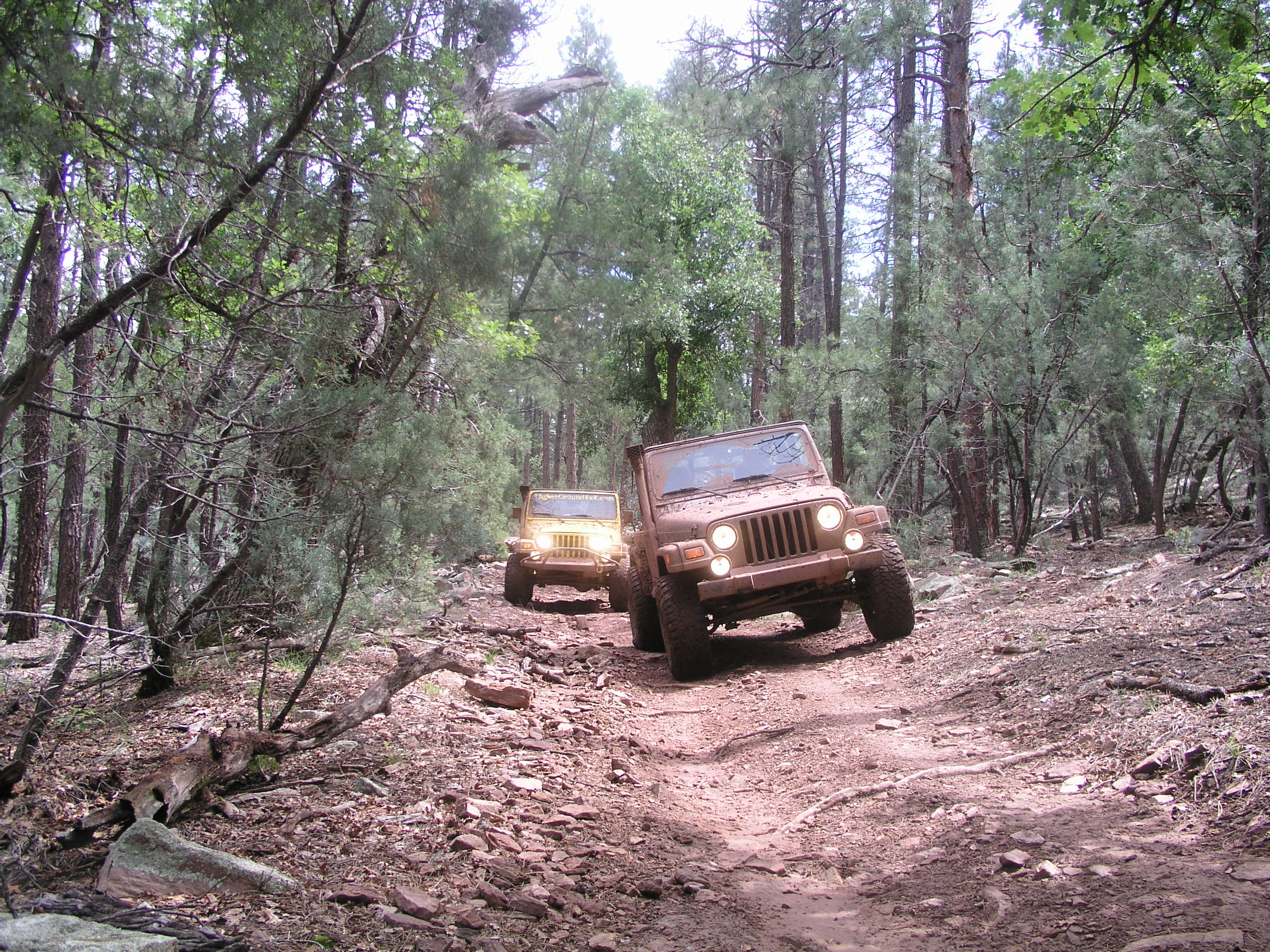
We went ahead and back trailed, then took the freeway towards Tonto Village. We ended up not only finding our next turnoff, but found a magnificent mud playground, where we turned a few sloppy puddles into a tree-mined field of sluice, and didn't stop until the Jeep's paint was almost completely camo'd. Still not much got into their cabs, even with J's back open, but some still found it's way even around Dana's jammer and onto the girls. After snapping some mud shots we pointed the Jeeps down the road we wanted that would take us to our final destination, an unmarked cave. We've been in a good many caves before, one of us even got a planes trains and automobiles ride out of one except it was the fire-rescue, ambulance, and helicopter version. Many of the ones we visit are well know and damaged like Peppersauce, some are gated and have a couple miles of passages, and some require harness and riggings. But we were headed to one of our fun finds, a relatively hidden cave that doesn't see too much traffic. We drove to about the spot we needed to be, undocked and secured the GPS and hiked right up to my last little blue marker and coincidingly the entrance of our cave. It turned out to be nothing like the size of some of the larger ones we've visited, but it had a few good sized rooms and many complete formations. J didn't come back to far with us, because of his broken arm, so Dana and I searched what looked to be the end and found a large crystal blue clear pool. Like the lake at Bells, it was hard to see where the ground stopped and the water started, but unlike the depth there, this one was only 3 feet deep. It had nice island like rock formations along the bottom, rising up like mushroom stepping stones to the top. We utilized Dana's digital camera's underwater feature and snapped some blue tinted formations beneath the service. The water was freezing so even though we had to pass through it to explore the back of the cave, I still didn't feel like dipping my head in to see what I was shooting with the camera, but the shots did come out sweet. After Dana searched a few rabbit holes, we started up the muddy slope to the upper room that would lead us out. We made it up and out to the welcoming sunlight. To make it back to the Jeeps, we again utilized the GPS since there was really no defined trail and the woods were kind of thick We hung out at the Jeeps for a little discussing our options, and decided we would would call it a day and return to explore more of our quadrangle next time. As we were packing back up, we noticed newly approaching clouds, looked lovingly at the now dried mud on the Jeeps, and decided to try to beat mother nature's plan to ruin the Wranglers' dirty trail badges. So we high tailed it back out to the highway and headed back toward Payson, getting hit with a few drops that had no effect on the caked mud J and Dana had worked on. We made it to Sonic, parked under cover and ate lunch, then headed back to Phoenix, where we knew for sure the mud would be safe from ruin. | 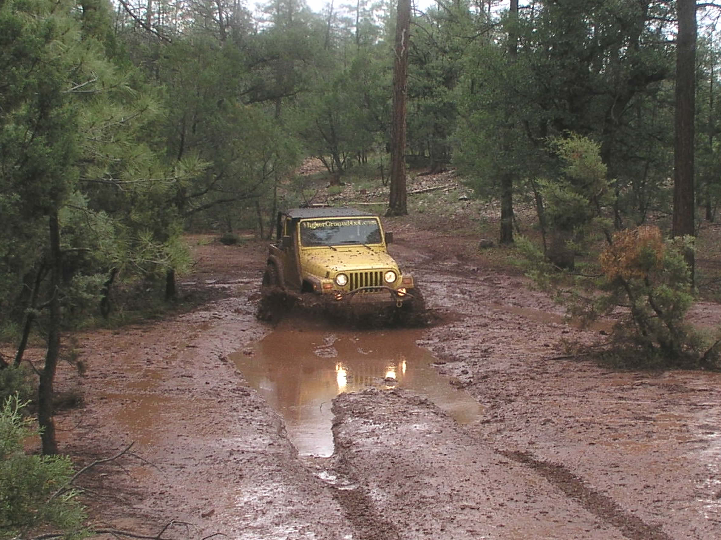 | ||
 | |||
 | |||
 | |||
 | |||
 | |||
 | |||
 | |||
 | |||
 | |||